Penarth Dock, South Wales - the heritage & legacy . . .
Volume One - Into the Victorian Age - The Penarth Shipbuilding & Ship Repairing Company Limited . . .
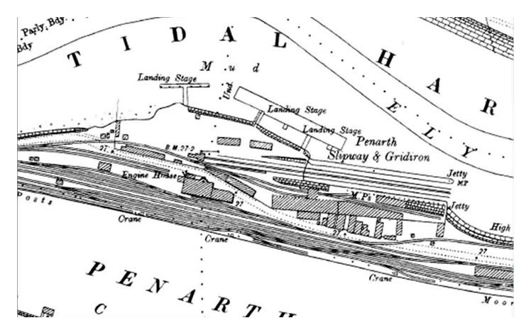
The c.1900 OS map of the area of the dock where the slipway and gridiron belonging to the Penarth Dock Ship Building & Ship Repairing Co. Ltd. are situated. The slipway was some 867 feet (264 m) in length and the gridiron 350 feet (107 m) long. These were considered to be extensive ship repair facilities for the time. [010]
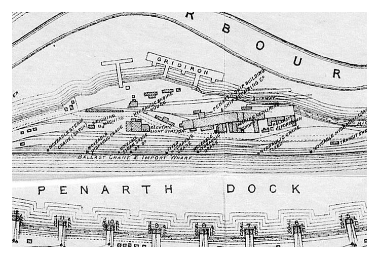
A section of the Taff Vale Railway map of Penarth Dock published in 1896 showing the premises and layout of the slipway and gridiron. Note also the "Marine Repair Shop". the "Electric Light Station" and the office of the "Ballast Foreman". [247]
The plan to build ship repairing facilities on the banks of the River Ely was nothing new as this newspaper advertisement of 1867 indicates:
"Notice - To Shipbuilders and Others - Penarth Dock and Tidal Harbour - The Taff Vale Railway Company are prepared to LET LAND to, and receive Offers from, Parties prepared to Construct and Work a GRAVING DOCK inside the Penarth Dock, also, GRIDIRONS and SHIPBUILDING CONVENIENCES on the Bank of the River Ely. Further information may be obtained by application to the Company Engineer. Edward Kenway, Secretary, Taff Vale Offices, Cardiff, 18th February, 1867."Glasgow Herald [196] 8th March 1867.
A side by side view showing the location of the Penarth Slipway and Gridiron in relation to the River Ely and former Penarth Dock in 2017. The OS map is from the series c.1890's onwards. [010][398][20180117]