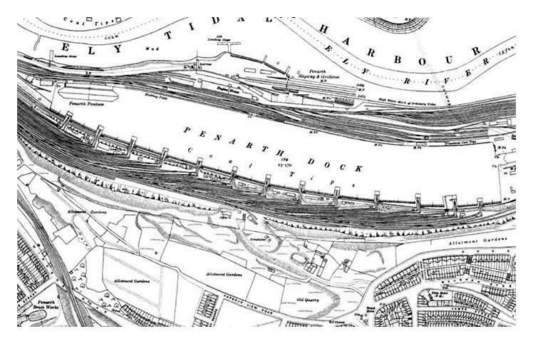
1915 - The 1915 OS map published c.1920 shows the pontoon at its berth and the engineering works of the Penarth Pontoon and Ship Repairing Company Limited, being the tapered rectangular figure sandwiched between the railway sidings.
The upper map shows that the Penarth Slipway and Gridiron are still in place on the banks of the River Ely and the path of the pedestrian tunnel may be traced from bank to bank of the Ely.
Above the dock, the old quarries are still marked but are being filled and the land converted for use as "Garden Allotments" as the quality of life, and the expectations of the local residents and dockworkers improves through the era. Paget Road is now developed and "Dagger Town" is losing its reputation as an unruly place to live. [010]