Penarth Dock, South Wales - 150 years - the heritage and legacy  
Penarth Dock, South Wales - the heritage & legacy . . .

Volume Six - Pre-Victorian to the Present Day - Select Aspects - A look at Cwtch-y-Cwm . . .

1830's map of River Ely and Penarth Head.
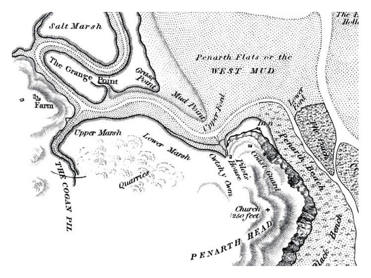
A section of 1830 OS map in the vicinity of Penarth Head. Cwtsh-y-Cwm is the pill close-by the Penarth Head Inn. The Inn was situated at the head of a shingle beach sheltered from the prevailing winds and within easy reach of Cardiff; the “centre of villainy.” Edwards, the landlord and an alleged smuggler was described as a “Victualler; an olde offender; with a design of defrauding the King of his Customs” according to the “Customs House Records, Letter Book of 1732-42.” Note the Upper and Lower Marshes; these being the proposed site of the Penarth Dock. [010]
 
Map of the mouth of the Rivers Taff and Ely - 1830's.
Another OS map published in the 1830 book “Nautical Observations on the Port and Maritime Vicinity of Cardiff” showing the mud flats to be navigated by mariners to reach Bute Dock or the mouth of the Glamorganshire Canal. The Taff Vale Railway is shown running parallel to the Bute ship Canal. [010] [126] 
© 2014 - 2025 - penarth-dock.org.uk - all rights reserved - web design by Dai the Rat