Penarth Dock, South Wales - the heritage & legacy . . .
Volume Six - Pre-Victorian to the Present Day - Select Aspects - A look at Cwtch-y-Cwm . . .
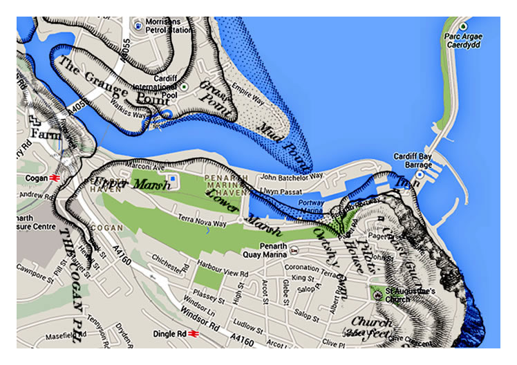
The 1830 OS map superimposed (best fit) upon the Google map of 2014 which clearly indicates the relative location of the Cwtsh-y-Cwm pill which intersects Penarth Portway and meets up with the escarpment at Dock Road, the steep hill which is adjacent to the Customs House. [110][010]
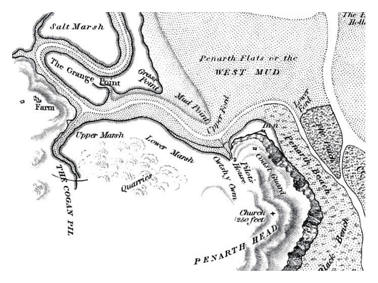
A section of 1830 OS map in the vicinity of Penarth Head. Cwtsh-y-Cwm is the pill close-by the Penarth Head Inn. The Inn was situated at the head of a shingle beach sheltered from the prevailing winds and within easy reach of Cardiff; the “centre of villainy.” Note the Upper and Lower Marshes; these being the proposed site of the Penarth Dock. [010]