Penarth Dock, South Wales - the heritage & legacy . . . |
Penarth Dock, South Wales - the heritage & legacy . . . |
|
Volume Six - Pre-Victorian to the Present Day - Select Aspects - A look at Cwtch-y-Cwm . . . |
|
|
|
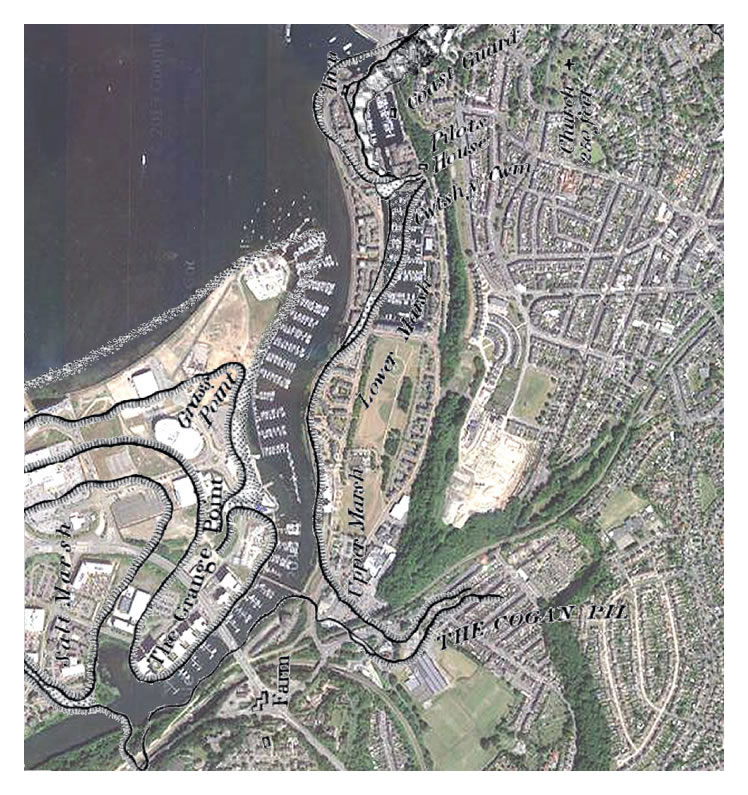
The 1830 OS map superimposed (best fit) upon the 2014 Google earth terrain map. The River Ely has been vandalised and diverted from its meanders for the sake of the recent Cardiff Bay “development” but this straightening of its course is nothing new since this was apparently considered during surveys undertaken or instigated by Brunel, Smeaton, Stephenson and Telford. [110] [010] |