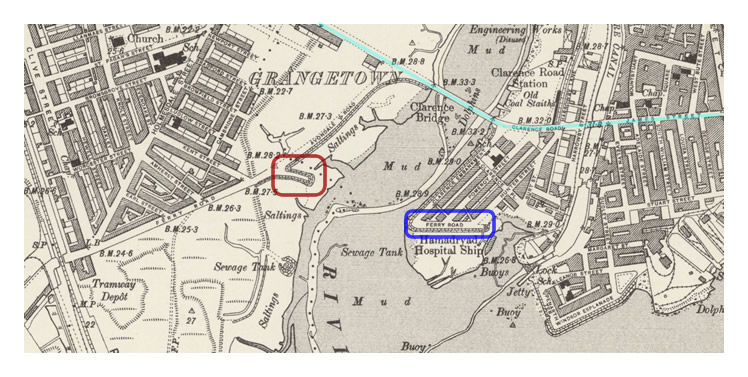
The OS map published in 1902 shows the route of the new Clarence Road bridge in pale blue. The remains of the masonry embankment roadway at Ferry Road on the Grangetown side of the river is highlighted within the red rectangle whereas the now severed Butetown Ferry Road is in blue. Compare the river path with the 1880's OS map (below) ; the dramatic deviation in the deep water channels are clear at the old swing bridge crossing which confirms the 1869 newspaper article statement ; 'they had now the anomaly of a bridge where there was no river.' [010] [398]