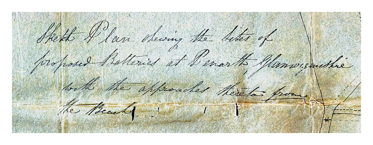
1855 - A Sketch Plan shewing the Sites of proposed Batteries at Penarth, Glamorganshire, with the approaches thereto from the Beach. The proposed sites are marked a and b on Plan and tinted red, and the rights of way forming the approach thereto are all tinted red. February 8th for J. E. Bernard, (Surveyor and engineer to Cardiff Local Board of Health), Engineer, Cardiff.
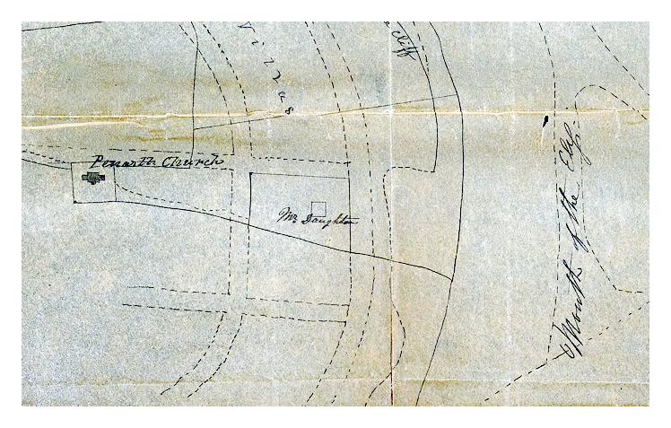
Location 'a' is the site of an 'Orchard' which is adjacent to the 'Preventative Station' and is situated on the headland above the 'The Head Inn' the site of the present day Customs House. The 'Proposed New Road up the Cliff' is roughly the route of the present day route. North (above) is labeled an area 'Low ground for Boat Yard'. Next to the 'Orchard' is a 'stable' and then 'Cliff House' prior to location 'b' which is labelled 'Quarry', which was presumably for gypsum or alabaster extraction. The road tinted red is labelled 'Land reserved for a roadway' and the 'upper edge of the cliff' is indicated with the 'Mouth of the Ely' below. The land on the church side of the proposed roadway is labelled 'Sites for Villas' and the property of 'Mr. Daughton' is indicated close to old 'Penarth Church'.
The original sketch plan is extremely difficult to read, hence, I have digitally enhanced the plan and enlargements to enable the text to be deciphered. To my best knowledge, these plans, however, did not materialise and a revised location and layout was realised in 1903, nearly fifty years later! The original sketch plan is held at the Glamorgan Archives. [Glamorgan Archives Reference : DPL-812-10] [599]
|