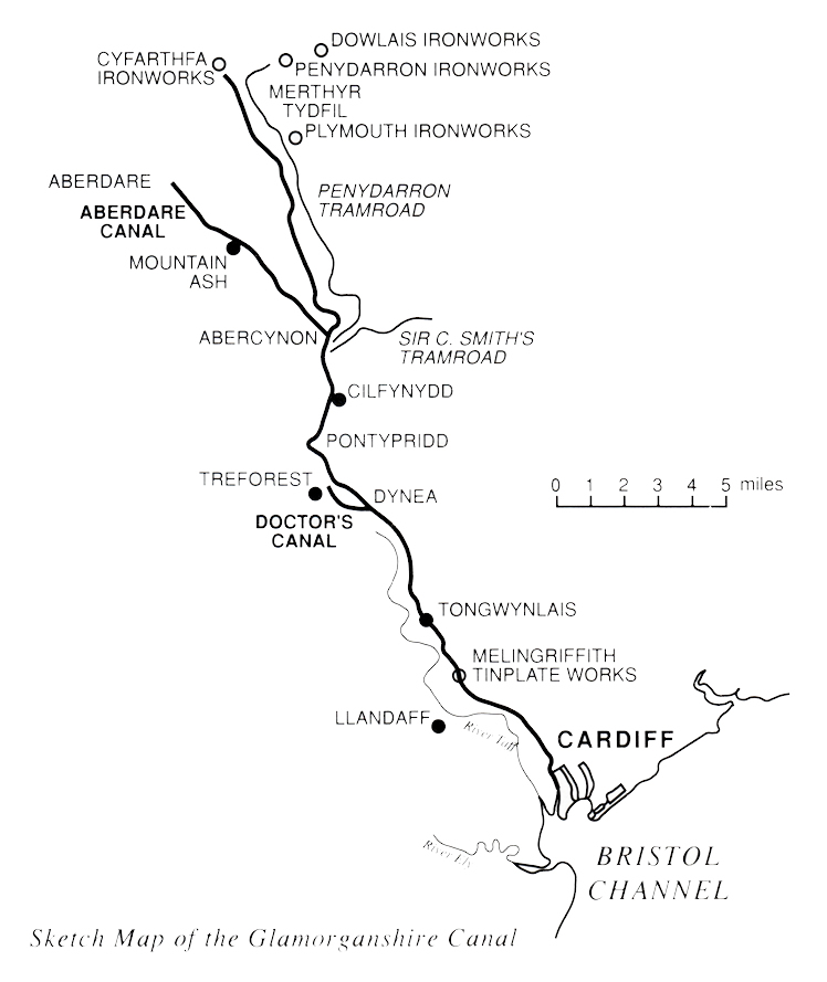
The Glamorganshire Canal, 25½ miles long, had a rise of 542 feet which required 52 locks to navigate. The final 1¾ miles to Dowlais and Penydarren works was undertaken by tramroad due to the rise of c.410 feet.
Dowlais - (1759 - Guest Family)
Cyfarthfa - (1765 - Richard Crawshay)
Penydarren - (1784 - Samuel Homfray)
Plymouth - (1763 - Richard Hill)
The above Sketch Map of the Glamorganshire Canal is borrowed from the March 1994 edition of Archive magazine. [631]
|