Penarth Dock, South Wales - the heritage & legacy . . .
Volume Twelve - Pre-Victorian to the Present Day - further aspects - Aerial Views - 1946 to 1981 . . .
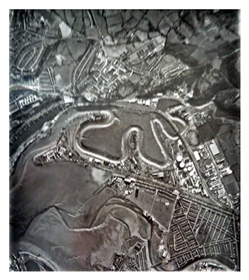
18th March 1968 - Image 0064 - This high level pass was taken by the RAF of the meandering River Ely and route of the railway past the Grangetown Gas Works with the Ely Tidal Harbour and western end of Penarth Dock visible. The photograph was not duplicated too well by me hence it is of lower resolution!
The image is credited to the Welsh Office. [1294][1292]
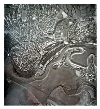
18th March 1968 - Image 0065 - A continuation of the high level pass of the RAF. The River Ely estuary and Basin and Penarth Dock plus Penarth Head visible. The photograph was not duplicated too well by me hence it is of lower resolution!
The image is credited to the Welsh Office. [1294][1292]
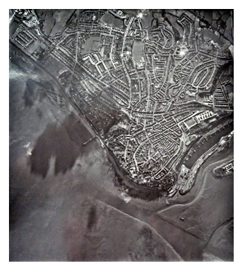
18th March 1968 - Image 0066 - A continuation of the high level pass of the RAF. Below the Penarth Head. The photograph was not duplicated too well by me hence it is of lower resolution!
The image is credited to the Welsh Office. [1294][1292]
18th March 1968 - An enlargement which shows that the Basin and Penarth Dock have now been separated by a dam with roadway across and that the lock gates and swing bridge are no longer in place!
The image is credited to the Welsh Office. [1294][1292]