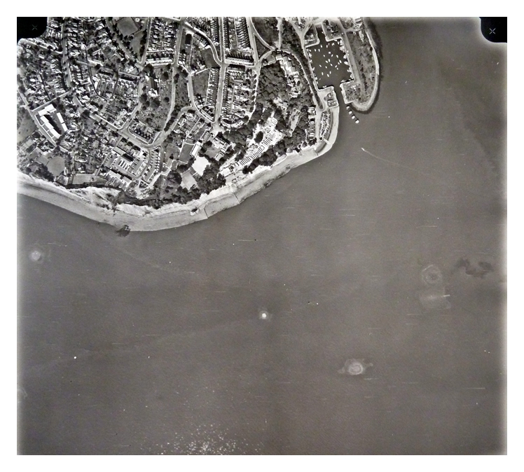
6th July 1971 - Image No. 9 853 - with enlargement - The view of Penarth Head, the Custom House [A] and former Mercantile Marine Offices [B] and the Penarth Dock Basin [C].
The basin is being used for berthing numerous small boats at this time. The sea-lock gates have been removed and the basin is now tidal and silting-up with each tide! The entrance pier on the southern side is now no longer in place leaving just the northern pier in place [D].
Some of the Quonson huts [E] are still visible being the remnants of the use of the dock as an American base during WWII. The entrance to the River Ely Subway [F] building is still visible. The lock between the Basin and Dock is dammed up, the lock gates have been removed and a roadway replaces the former swing bridge. [G]
The image is credited to Clyde Surveys Limited and Glamorgan County Surveys. [1297] [1298] [1292] |
![6th July 1971 - Image No. 9 853 - with enlargement - The view of Penarth Head, the Custom House [A] and former Mercantile Marine Offices [B] and the Penarth Dock Basin [C].](/images/121204001b-700.jpg)
![6th July 1971 - Image No. 9 853 - with enlargement - The view of Penarth Head, the Custom House [A] and former Mercantile Marine Offices [B] and the Penarth Dock Basin [C].](/images/121204001c-700.jpg)