Penarth Dock, South Wales - the heritage & legacy . . .
Volume Twelve - Pre-Victorian to the Present Day - further aspects - Report upon Penarth Dock - 1984 . . .
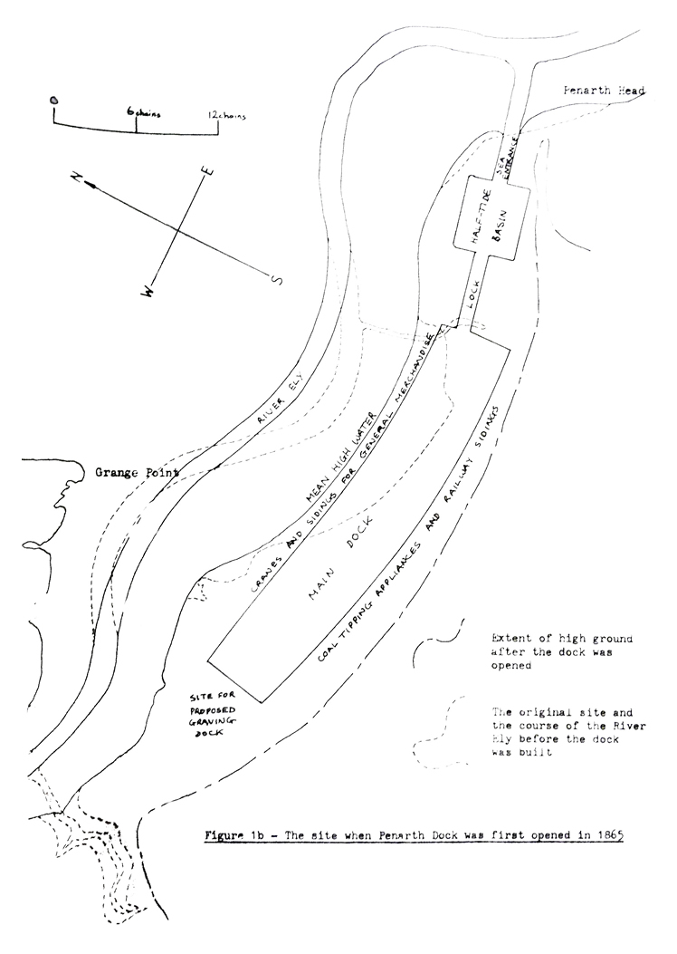
Figure 1b - The site when Penarth Dock was first opened in 1865. [1292]
The following text is taken from Appendix A - Details of Illustrations:
This figure is loosely based on a plan annexed to an Agreement dated 5th June 1857. Figure 1b includes information taken from recent plans to show the approximate new course of the River Ely and outline of the dock as it was at the time. Note that the reclamation of land at Grange Point to provide more area for Ely Tidal Harbour is not shown.