Penarth Dock, South Wales - the heritage & legacy . . .
Volume Twelve - Pre-Victorian to the Present Day - further aspects - Report upon Penarth Dock - 1984 . . .
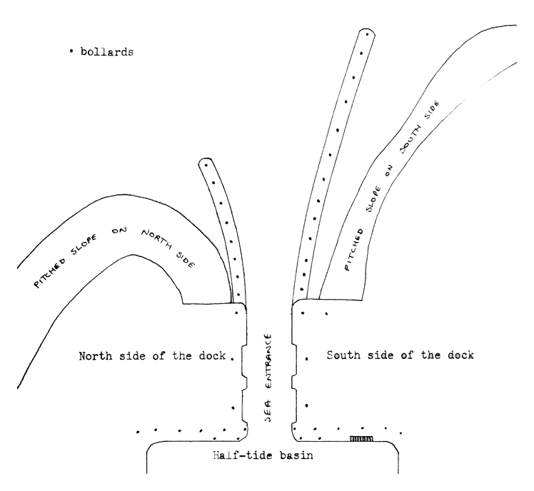
Figure 2c - The entrance to Penarth Dock in the 1890's. [1292]
The following text is taken from Appendix A - Details of Illustrations:
This figure is based upon a 1 : 1250 Ordnance Survey map of the dock with details of entrance jetties taken from other sources. Figure 2c is based on the fact that although the extended jetty is featured on plans dated in the 1920's the absence of earlier plans and the fact that the entrance channel was deepened in the 1890's seems to indicate that it dates from this time.