Penarth Dock, South Wales - 150 years - the heritage and legacy  
Penarth Dock, South Wales - the heritage & legacy . . .
Volume Twelve - Pre-Victorian to the Present Day - further aspects - My Trip to Flat Holm - 2024 . . .
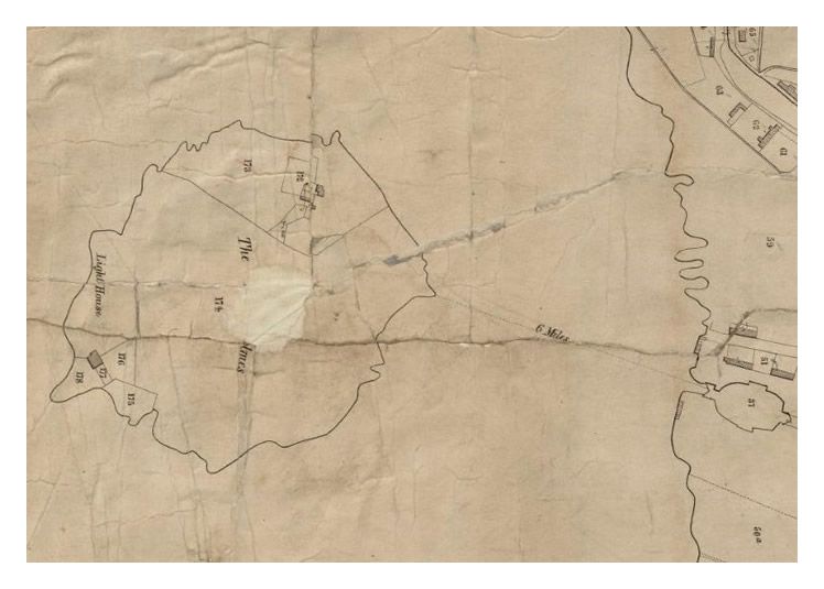
1845 - The Tithe Map of the Parish of St. Mary's, Cardiff - The Tithe Map dated September 1845 provides an insight into the 'Occupiers' of the Flat Holme Island at that date.

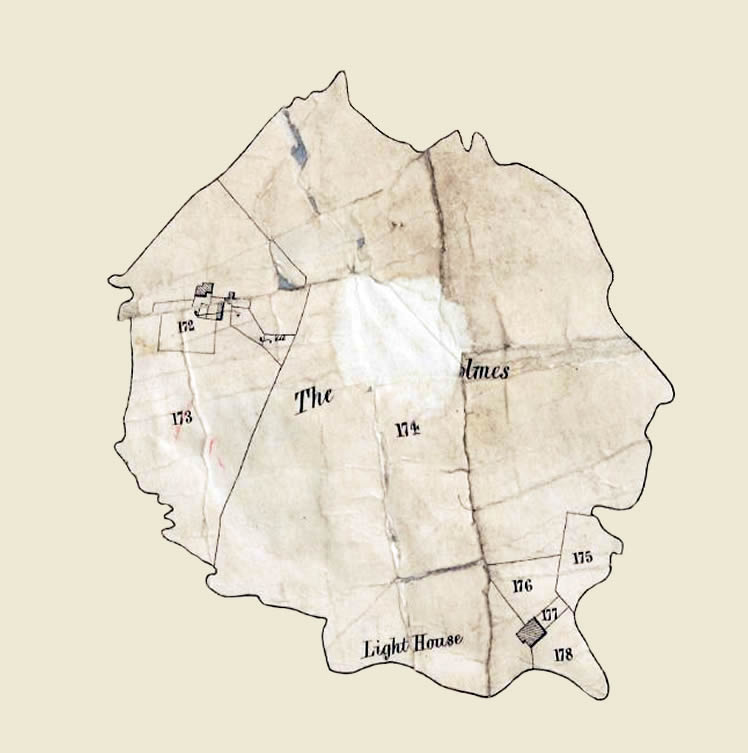
1845 - The Tithe Map of the Parish of St. Mary's, Cardiff - The Tithe Map dated 30th September 1845 provides an insight into the 'Occupiers' of the Flat Holme Island at that date. The 'Landowner' was the Marquis of Bute. The Map is courtesy of The National Library of Wales. [439]

The title of the island is 'The Flat Holmes.' Does anybody know whom was Stephen Horsley please?

The table below summarises the occupier, tithe value, and use of the 'Fields.'

Field Number
Field Name
Occupier
Land Use
Tithe Value
172
Homestead
Stephen Horsley
Pasture
3d
173
-
Stephen Horsley
Meadow
1s 10d
174
-
Stephen Horsley
Pasture
7s   6d
175
Garden
Stephen Horsley
Pasture
1d
176
Garden
Trinity Company
Pasture
3d
177
Lighthouse & Dwelling
Trinity Company
Pasture
26d
178
-
Trinity Company
Pasture
3d
© 2014 - 2026 - penarth-dock.org.uk - all rights reserved - web design by Dai the Rat