|
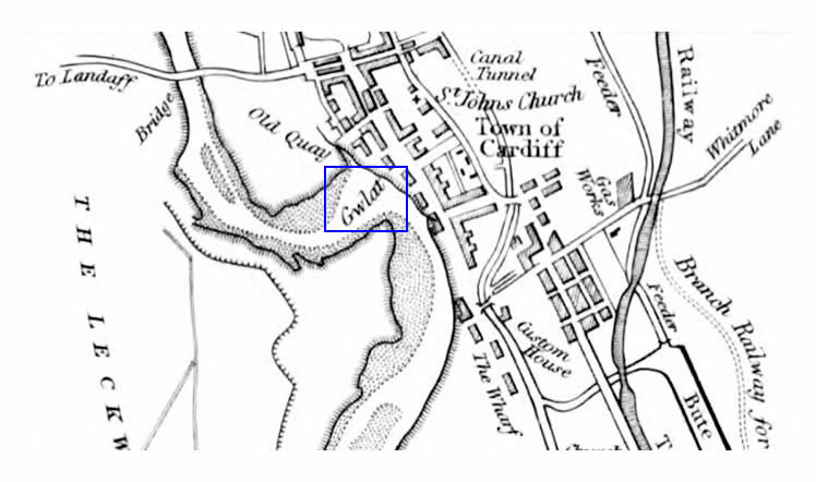 |
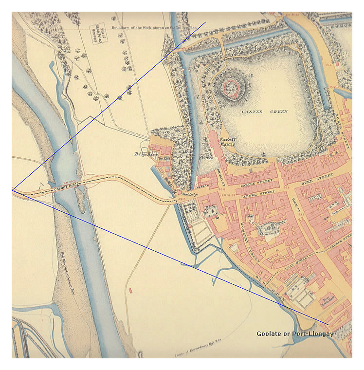
The quayside named 'Gwlad Quay' or 'Gwlat' (which became known in the period as 'Cannon Wharf'), situated off the Old Quay in Cardiff, was apparently built by Anthony Bacon (1718–1786) and the 25 mile long turnpike-road was used to convey cannon from Merthyr to Cardiff on horse drawn wagons. Cannon was exported for the American War of Independence (1775-1783) and to continue to annoy the French (>1,000 years and ongoing!).
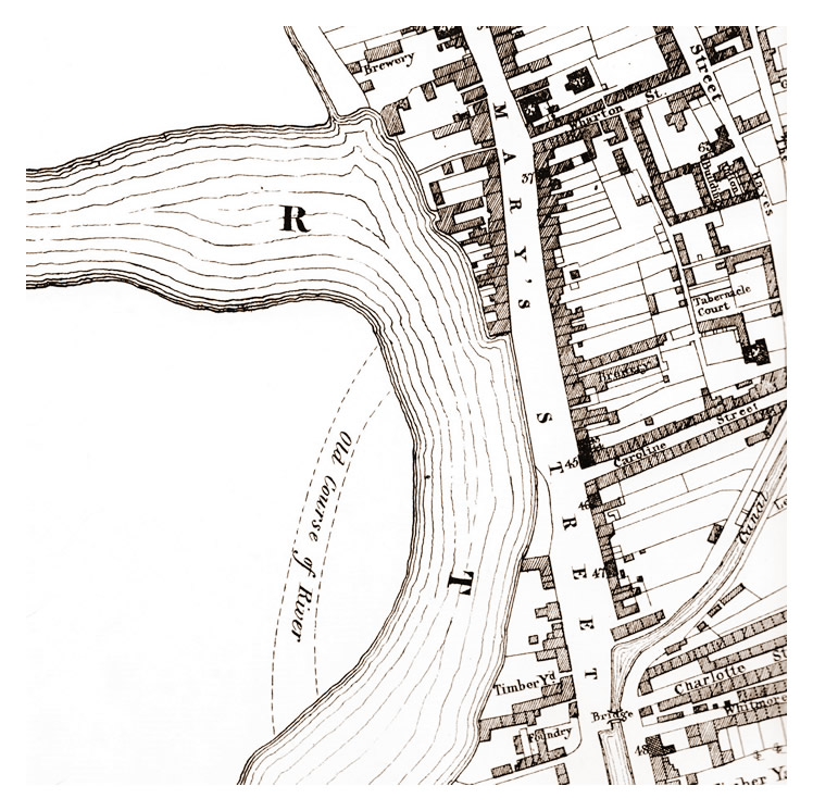
The River Taff was diverted for the construction of the new GWR station during the mid to late 1840's under the designs of Isambard Kingdom Brunel. The portion of the map above [126] shows the original route of the river and location of the wharves along the banks of the river Taff running, for the most part, parallel to St. Mary's Street.
A possible translation of 'Gwlat' is perhaps relating to a tank or tub used to hold liquid ; maybe, in this case a vat of hot tar used for making ships watertight by caulking when the tide is out? 'Caulking ships with tar involves using oakum (tar-soaked hemp or flax fibers) to seal the seams between wooden planks, making them watertight, especially below the waterline, with pine tar (Stockholm tar) keeping it pliable and rot-resistant, followed by a sealant like pitch or putty. This traditional method drives tarred oakum into the gaps with a caulking iron, then "pays" (seals) it with melted pine tar or pitch for a durable, waterproof finish, preventing planks from shifting and leaking'.
|
|
Anthony Bacon (1718–1786) and partner, Charles Wood, developed the 'Pot and Stamping' process at Cyfartha iron works, Merthyr, for refining iron from which they cast and subsequently bored cannon for both the British arsenals and at least one enemy of the Realm!
During April 1775 an order for 195 guns (4 to 32 pounders) was placed by the Board of Ordnance, however, this contract was forfeited, it is said, 'from proof presumptive that the enemy procured a supply of great guns from the same source'! Bacon, it is said, had sold cannon to the French and contracts were lost to the British Carron Company. |
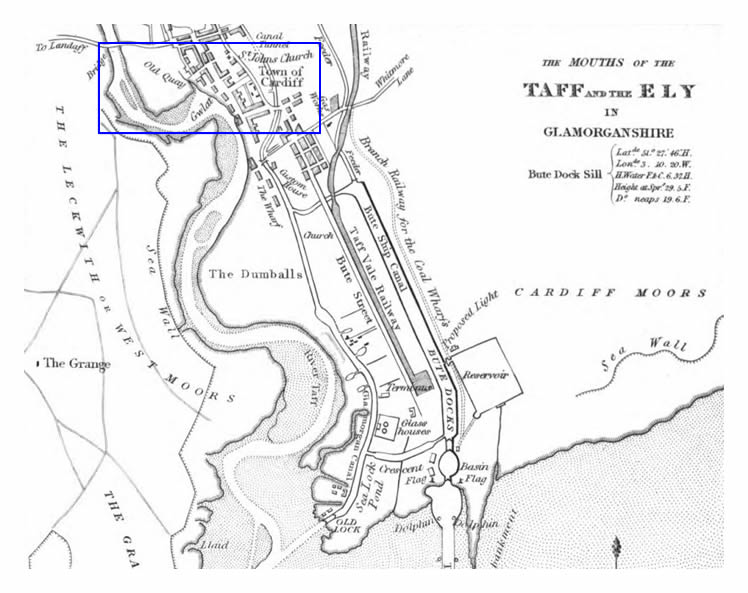
'Nautical Observations on the Port and Maritime Vicinity of Cardiff' by W. H. Smyth [126] was published in 1840 from which the above town plan was borrowed and which stated : -
With such stimuli to mining and smelting, a demand naturally arose for increased facility of transport to other parts of the world. Among the means of embarking and exporting these products, the river Taff was the principal outlet ; and the so-called Port of Cardiff was held to be in extreme activity half a century ago, when the comparatively scanty supply was brought down from the hills in waggons, each bringing two tons, drawn by four horses, and attended by a man and a boy.
Even Mr. Bacon's contract guns * in the American war, were thus conveyed for embarkation to the side of the Gwlat Quay, which from that circumstance was known for some time afterwards as the "Cannon Wharf," though that name has long been lost ; and it is a proof of the growth of the town since that time, that the guns used to be proved from the street before this quay (St. Mary's), against the earth bank of the South Wall, across the end of the street; there being then no houses beyond the then gate, called Port-Llongay.
* This contract was forfeited, it is said, from proof presumptive that the enemy procured a supply of great guns from the same source.
|
|
 |
| late 1830's (or early 1840's) - A section of the town plan prepared for John Crichton Bute, Marquis of Bute, by John Wood, showing the extent of wharfage on the river Taff adjacent to St. Mary's Street, Cardiff. The 'Gwlat' wharf, though not indicated, appears to be situated at the rear of buildings and land which may have been used as warehousing, etc. At this date, however, the Glamorganshire Canal (fully opened June 1798), the Bute Ship Canal (West Dock) (opened in 1839 ) and Taff Vale Railway (opened to West Dock in 1841) are indicated on the plan, hence, the wharves on the Taff may have become less important and may have fallen into disuse. [599] |
|
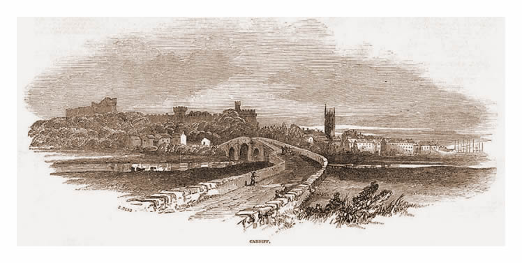 |
| 1851 - A view from the 'Cardiff Bridge' with the castle, St. John's church tower, and to the right the masts of sailing ships moored up at 'Old Quay' adjacent to St. Mary's Street - see town plan below. This view was published within the Illustrated London News during 1851. [121] |
|
 |
1851 - A town plan of Cardiff / Caerdydd surveyed during 1851 'in accordance with the provisions of the Public Health Act' which provides us with an understanding of the layout of the town and an approximation of the field of view in the engraving above. By this date the Cardiff Station had been built and the route of the river Taff diverted through a 'New Cut' leaving minor waterways to service the old wharf area. [599] |
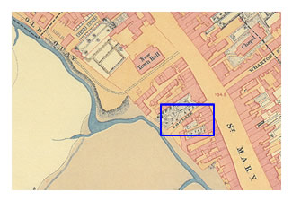 |
The Goolate, as indicated on the 1851 town plan, links the present-day Westgate Street with St. Mary Street (on earlier plans St. Mary's street) and is an ancient lane which contained four dwelling houses, stables and a black-smith workshop and yard. The blue plaque at the Golate House states that this lane was formerly 'Known Variously As Porth Llongau, Ship's Gate, Frog Lane, Golygate and Gulleygate.'
Porth Longau ('Ship Port' or 'Ship Gate') is referenced within the 'Nautical Observations on the Port and Maritime Vicinity of Cardiff' by W. H. Smyth.
When the Fire Station was built in Westgate Street the contractors unearthed a walled dry dock while excavating for the foundation. [1367] |
| |
| 1880 - Feeling hungry? - 'Oysters, Fresh Daily - Dozen Oysters, Bottle Stout, Bread and Butter, for 9d. (3.75p!) Ship on Launch (public house), Quay Street.' - South Wales Daily News [325] [361] 10th January 1880. |
|
|