|
|
Penarth Dock, South Wales - the heritage & legacy . . . |
|
|
Penarth Dock, South Wales - the heritage & legacy . . . |
 |
|||||
 |
Volume Ten - Pre-Victorian to the Present Day - Even more aspects - Penarth Dock and Llandough Fields Reclamation Report : 1989 . . .
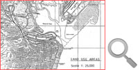
Area 1 - Llandough Fields : Between the time the railway was built and the present time, there have been relatively few changes to this area. The Llandough Moors, as the fields were called on Ordnance Survey Maps, were low lying fields protected from flooding by a raised. river bank. In order to drain the area adjacent to Penarth Road a ditch was cut across the site (the end of this ditch is still visible by the advertisement hoardings on Penarth Road). At the beginning of the Century, when the railway was at its busiest, a second railway bridge was constructed over the River Ely providing a total of four tracks over the river. In recent times miscellaneous waste material has been dumped in the area, giving a relatively level surface between the top of the raised river banks and the Penarth Road, which had been built on a small embankment. The new peripheral distributor road now crosses this area. Area 2 - between Penarth Road and the railway : At the time the dock was built, this area was crossed by a railway line, serving lime works on the west side of Penarth Road. Little or no development took place until after the Second World War, when the existing buildings were erected. The former garage on the Penarth Road, at the northern end of the area, is currently boarded up. Area 3 - between the railway and the River Ely : At present this area abuts four railway tracks. However, at the time the dock was opened there were about nine tracks and this number was increased subsequently to as many as twenty two lines. |
||||
| Introduction | |||||
| Contents | |||||
| Search this site | |||||
| Contributions | |||||
| Links | |||||
| Recent Updates | |||||
|
|||||
| | volume 10 | chapter 16 | page 060 | << previous page << | index to volume ten | >> next page >> | | |||||
|
|||||